

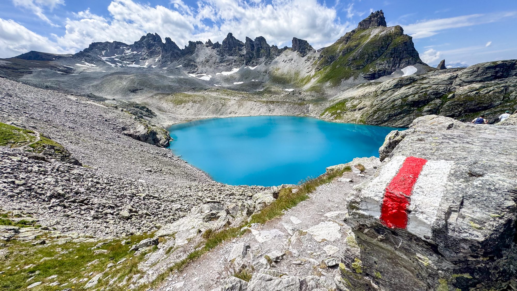
St. Gallen Heidiland Hikes and trails Hike guide
Pizol 5 lakes hike
- Distance
- 11.4 km
- Walking time
- 4 h 30 min
- Ascent / descent
- 553 m / 911 m
- Difficulty
- T2 · Moderate
By Mihaela CanjaLast checked 30 September 2026
The Pizol 5 lakes hike is a popular, scenic mountain hike that links five alpine lakes across a rocky landscape above the tree line. It is popular for a reason: the landscape is striking and the hues of some of those lakes look surreal on a sunny day.
It is well worth the hike, which covers 11.4 km from Pizolhütte to Gaffia, and the repeated climbs and the long final descent make it more demanding than the distance suggests. Reported crowds can make the hike feel more tiring, so it is worth planning how to avoid them.
Important: the last chairlift from Gaffia sets your deadline, and the pretty narrow and steep path gets crowded near that time on the descent. Moving rocks on that narrow, steep path mean the crowds slow you down a lot.
I walked it after a late start, which gave me quiet lakes but little time to linger, so this guide looks closely at timing, lift deadlines and costs.
Hike facts
- Distance
- 11.4 km 7.1 mi
- Ascent / descent
- 553 m / 911 m 1,810 ft / 2,990 ft
- Walking time
- 4 h 30 min
- Difficulty
- T2 · Mountain hiking · Moderate
- Fitness required
- Good fitness required
- Route type
- Point to point
Best time
Best: September. Good: July and August. Possible: late June and October, depending on snow. In 2026 the lifts run from 19 June to 18 October.
Getting there
- Region
- St. Gallen › Heidiland
- Start
- Pizolhütte, reached from the Wangs valley station by gondola and two chairlifts
- By train and bus
- Train to Sargans, then bus to Wangs, Pizolbahn
- Stations and stops
- Wangs, Pizolbahn (bus)
- By car
- Pizolbahnen valley station, Pizolstrasse 3, 7323 Wangs
Practical
- Cost (2026)
- 5 Lakes Hike ticket (estimate): adult CHF 64, child CHF 32, CHF 32 with GA or Half Fare
- Services
- Pizolhütte at the start, Alte Alp Gaffia (summer only) at the end, no refreshments on the trail
- More info
- Pizol 5 lakes hike · Operating times summer · Prices summer · Trail conditions
Getting there
The trip starts and ends at Wangs, so you finish at the valley station where you began, even though the trail is one way. Use the Wangs valley station, not the Pizol gondola in Bad Ragaz.
By public transport, take the train to Sargans and change to the bus to Wangs, Pizolbahn. The bus stop is a short walk across the car park from the gondola station.
For connections and approximate journey times from Zürich and Luzern, see How do I get to Wangs from Zürich or Luzern?
From Wangs, the gondola takes you to Furt, and two chairlifts via Gaffia continue up to Pizolhütte.
If you drive, there is paid parking beside the valley station, about CHF 6 per day in summer 2026 (estimate), with the first 45 minutes free.
Lift times, summer 2026: the lifts run daily from 19 June to 18 October 2026.
- Wangs ⇄ Furt gondola: first up 8:15, last down 17:30.
- Furt ⇄ Gaffia chairlift: first up 8:30, last down 16:30.
- Gaffia ⇄ Pizolhütte chairlift: first up 8:45, last down 16:00.
Pizolbahnen expects the hike to be accessible from the beginning of July. Season dates change every year and can be postponed or changed because of snow and weather, so check the operator’s mountain summer report before you go.
The route
On the route
- Highest / lowest point
- 2,506 m / 1,861 m 8,220 ft / 6,110 ft
- Path
- Mountain path over scree and rocky ground
- Latest start
- 11:00 from the valley station in Wangs
- Last lift down
- 16:30 from Gaffia (16:00 from Pizolhütte), last gondola from Furt 17:30

This is a high alpine trail, above the tree line, with three strenuous ascents and descents. The upper section crosses scree and rocky ground, so hiking or trail-running footwear with good grip is mandatory. I personally prefer hiking boots to protect my ankles from being hit by the rocks. (Busy, relatively narrow path at descent with “rolling stones” makes this likely there).
The trail is marked white-red-white, which means a mountain hiking trail, and on the SAC scale these trails mostly sit between T2 and T3. T2 means a path with a continuous track and partly steep terrain, where a fall is not excluded and basic sure-footedness is needed.
There can be a few variations of this path. It is mostly T2 with a few short T3 sections that can be avoided. When you plan, check swisstopo, Komoot or Outdooractive to find the trail that fits your skill level. I would take the white-red-white marking as the more useful signal: this is a mountain hike, not a lakeside walk.
Food and water: there are no refreshment stops on the main trail, so carry water and food. Pizolhütte is at the start, and Alte Alp Gaffia, a mountain restaurant open only in summer, is at the end at 1,861 m.
Pizolhütte to Wangsersee
The hike starts at Pizolhütte at 2,227 m. Wangsersee lies a few minutes away in the opposite direction from the main trail, and it is easy to miss if you start climbing straight away. Take the detour before you set off: it is the first of the five lakes, so without it you only see four.


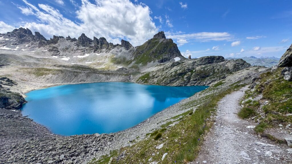
Pizolhütte to Wildseeluggen and Wildsee
The first sustained climb leads up to the highest part of the route, at about 2,506 m. In about an hour, Wildsee appears below the pass, in a rougher and more dramatic landscape than around the first lake.


A hunting reserve stretches from Wildseeluggen to Schottensee. Camping and bivouacking are strictly prohibited there, and inspections take place.


Schottensee to Schwarzsee
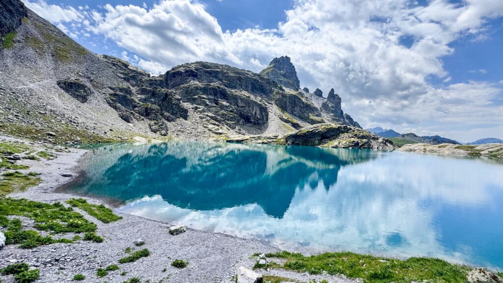
From Wildsee the trail descends to Schottensee, then climbs again over rocky terrain. It continues towards the darker Schwarzsee and across a wide plateau scattered with cairns. The Swiss Hiking Trail Association estimates 2 h 13 min from the hut to Schwarzsee.

Baschalvasee to Gaffia
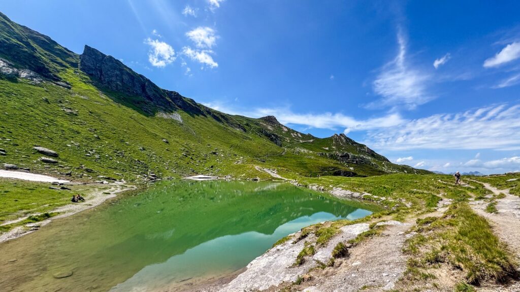
Baschalvasee is the last lake, reached at about 3 h 05 min on the Swiss Hiking Trail Association’s timing, but the effort is not over yet. An undulating section leads to the long descent to Gaffia. The route ends lower than it starts, yet there are three separate climbs along the way and about 900 m of descent in total. The last stretch is steep and feels long after the earlier climbs, and walking poles help here. This is where I met the crowd, only on the last descent.

How long it takes
Pizolbahnen and the signposts estimate 4 h 30 min. Other sources give shorter times: 3 h 45 min from the Swiss Hiking Trail Association (Schweizer Wanderwege). Swisstopo, Komoot and Outdooractive use different algorithms and arrive at different estimates again, and the distance shifts slightly with shortcuts and detours for photos, so treat any estimate as a guide that can vary a lot.
My own time was 2 h 53 min moving and 3 h 34 min in total, including photo stops, but that should not be used for planning. I had tracked my pace on many hikes this season and knew this terrain. Plan for 4 h 30 min plus breaks and time at the lakes.
Starting late
I walked it in July and started later than I would normally recommend, setting off from Pizolhütte at 12:30. The lift staff warned me I might not reach Gaffia in time, so I checked my pace against the elevation profile throughout and kept my stops short. My total of 3 h 34 min includes the photo stops and the Wangsersee detour, which put me at Gaffia at about 16:04, roughly 26 minutes before the last chairlift at 16:30. That is not a comfortable margin on a hike this long.
The late start had a clear trade-off. I had no time for long photo stops, but I also avoided the crowds usually reported on this trail. It only became busy on the last descent, where I caught up with the crowd.
Even so, I would not recommend starting late to anyone, unless they know their pace very well on this specific terrain, with this ascent and descent. I carried on because I had tracked my pace consistently over many hikes this season, so I knew I could manage with a margin.
The official advice is different. Pizolbahnen strongly recommends starting from the valley station by 11:00 at the latest. You need to be at the Gaffia chairlift by 16:30 or at Pizolhütte by 16:00, and the last gondola from Furt leaves at 17:30. After that, transport by Pizolbahnen is no longer possible.
Next time: walking it in reverse
Next time I plan to walk it in reverse, from Gaffia up to Pizolhütte. This is a plan, as I have not done it yet. The ascent would be significantly bigger, roughly 911 m up and 553 m down on the official figures, but I expect to reach the second and third lakes (Wildsee and Schottensee) without the crowds, and with no risk of missing the last chairlift. My knees will thank me.
In reverse, the deadline at Pizolhütte is 16:00, half an hour earlier than at Gaffia. Pizolbahnen’s start advice is written for the usual direction, so check with the ticket office before you plan it.
Who it suits
This hike suits people who, based on previous experience, are comfortable gaining and losing that much elevation on uneven, unstable terrain over about 4 h 30 min of mountain trail, with repeated climbs and a long, steep descent over rocky ground, and who can keep to a schedule set by the last lift.
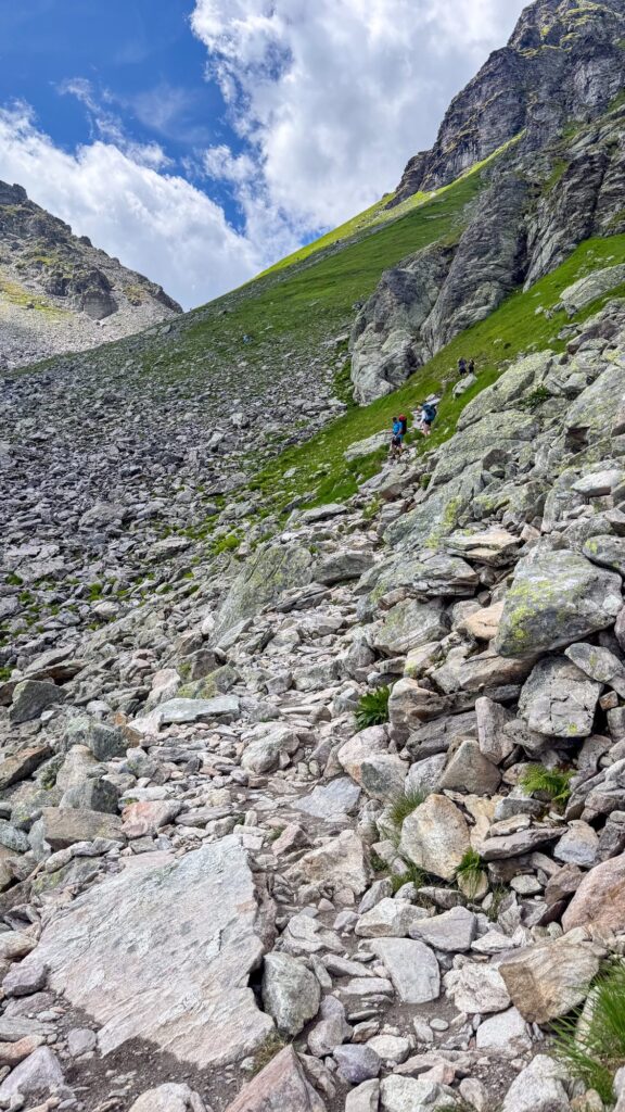

Many beginners choose a hike by looking only at the climb and assume the descent will be easy, but most falls on mountain trails happen on the way down, when legs are tired, concentration fades and every step needs more control than on the way up.

It does not suit anyone looking for a relaxed lakeside walk, or anyone who wants to linger at every lake and start late. If long descents are hard on your knees, the reverse direction may be worth considering once you have checked the timings.
Costs
All prices are estimates per person for summer 2026, checked on 30 September 2026, and they can change.
| Item | Adult | Child (6 to 15) | GA travelcard or Half Fare Travelcard (HTX) |
|---|---|---|---|
| 5 Lakes Hike ticket (estimate) | CHF 64 | CHF 32 | CHF 32 |
| Parking in Wangs, per day (estimate) | CHF 6 |
The tickets are personal and non-transferable. The Swiss Travel Pass is the tourist version of the GA, so holders can expect the GA price of about CHF 32.
Train and bus to Wangs, Pizolbahn, one way, 2nd class (SBB, checked 4 October 2026):
| From | Approx price with Half Fare | Approx price without Half Fare |
|---|---|---|
| Zürich HB | from CHF 18.90 | CHF 38 |
| Luzern | from CHF 28.40 | CHF 57 |
The price without Half Fare is twice the Half Fare price. “From” means the price can vary with the ticket type.
Tips
- Start from the valley station by 11:00 at the latest. Earlier gives you more time at the lakes.
- Check the Pizolbahnen mountain summer report for trail conditions before you go.
- Wear hiking boots with good grip, and take poles for the descent to Gaffia.
- Carry water, food, sun protection, a warm layer and waterproofs, even when the forecast looks stable.
- There are no refreshment stops on the main trail. Pizolhütte is at the start, and Alte Alp Gaffia, a mountain restaurant open only in summer, is at the end, so carry enough water and food for the whole hike.
- Do not camp or bivouac between Wildseeluggen and Schottensee.
- Dogs are allowed on the hike. Pizolbahnen charges about CHF 9 for a dog day ticket (estimate).
- The Swiss Hiking Trail Association notes that clear autumn days show the lake colours and the views of the first snow on the peaks at their best, although most plants have finished flowering by then.
- Treat the lift times as fixed points: Gaffia 16:30, Pizolhütte 16:00, Furt gondola 17:30.
Useful links
Questions
How long does the Pizol 5 lakes hike take?
Pizolbahnen and the signposts give 4 h 30 min. The Swiss Hiking Trail Association gives 3 h 45 min and MySwitzerland 3 h 50 min, and my own moving time was 2 h 53 min. Plan for 4 h 30 min plus stops, and expect the estimate to vary between sources.
What time should I start?
Pizolbahnen recommends starting from the valley station by 11:00 at the latest. You need to be at the Gaffia chairlift by 16:30, otherwise you miss the last descent. An earlier start is safer and leaves more time at the lakes.
How difficult is it?
It is a white-red-white marked mountain trail. I rate it T2, with short T3 sections that can be avoided, while the Swiss Hiking Trail Association rates its version T3. Expect rocky ground, three climbs and a long, steep final descent.
Where do I start, and which lifts do I take?
Start at the Wangs valley station, not Bad Ragaz. Take the gondola to Furt, then two chairlifts to Pizolhütte. The hike ends at Gaffia, and you ride the lifts back down.
How do I get to Wangs from Zürich or Luzern?
From Zürich: take the IC 3 from Zürich HB to Sargans, walk about 3 minutes to the bus stop, and continue by bus to Wangs, Pizolbahn. Approximate transfer time starting from 1 h 8 min, with one change at Sargans.
From Luzern: take the IR to Zürich HB, change to the IC 3 to Sargans, and continue by bus to Wangs, Pizolbahn. Approximate transfer time starting from 2 h 11 min, with two changes, at Zürich HB and Sargans.
These times are from the SBB timetable for Sunday 4 October 2026 (timetable year 2026) and can differ on other days and in other seasons, so check the SBB timetable for your travel date. Ticket prices are under Costs.
Is there food or water on the trail?
There are no refreshment stops on the main trail. Pizolhütte is at the start, and Alte Alp Gaffia, open only in summer, is at the end.
When is the hike open?
In summer 2026 the lifts run daily from 19 June to 18 October, and the trail is expected to be accessible from the beginning of July. The Swiss Hiking Trail Association points to clear autumn days for the best lake colours and views.
Questions and comments
Ask about the route, or share how it went for you. I read every comment and reply here. Comments appear after I have checked them.
No comments yet. Questions are welcome.